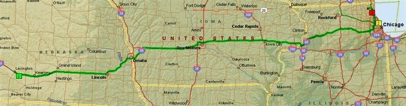
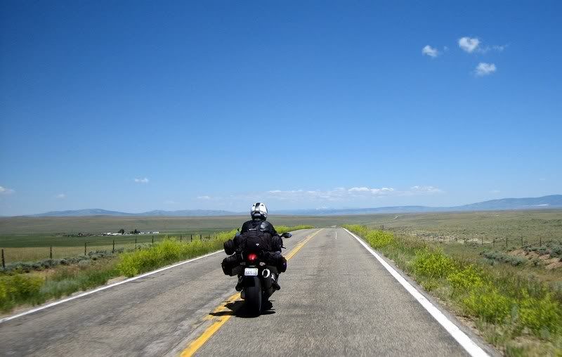
Day 10 Saturday, July 7, 2007 Start: Lexington, NE, 8:00 am End: Grayslake, IL, 11:00 pm Mileage: 715
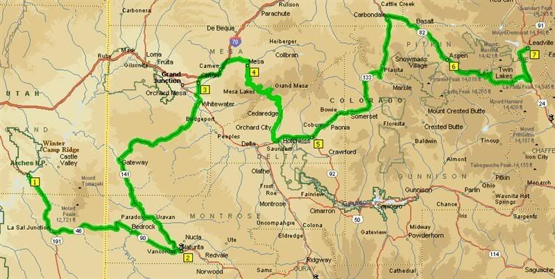
The route for Day 10: Lexington, NE to Grayslake, IL. Slabbing the remaining 700 miles to home.
We had good weather today and simply rode across on I-80 all the way to Illinois where we caught I-88, which was again very pleasant with no traffic. As I got closer to Chicago, the feeling of having to deal with bad drivers, traffic, construction, etc. didn't upset me as much as I knew that I had just enjoyed 8 days of beautiful riding on mountain passes and in deep canyons...
Epilogue What a fantastic ride that was through beautiful Colorado, Arizona and Utah. It was everything I expected and more. The twisties we rode were mainly the big state highways and I'm sure there's lot of smaller roads to enjoy in that part of the country. And thanks to the relative remoteness of the western states compared to the mid-west and the east, there was less traffic on the roads and therefore less enforcement. However, being a holiday weekend, we did encounter our fair share of cager traffic.
Besides the federal ticket that Andy and I got, there weren't any other real upsets on the trip. Aileen did drop her bike but it sustained no real damage and I'm surprised Rick didn't drop his ST3 on this trip. Maybe, he doesn’t need those training wheels after all. Weather-wise too, we only experienced one day of real heavy rain over Independence Pass and some sprinkles here and there. It was definitely hot in Arizona, but nothing unbearable. Too bad the moto-camping didn't work out as planned, but all the other accommodations were as we expected.
Regarding costs for the trip, per person we spent about: $200 for 10 days of lodging; around $400 in gas; $300 in food and about $35 in park entrance fees for an average daily cost of $94. That's an excellent price considering the fun we had and the places we went.
The planning for next year's trip has already begun...
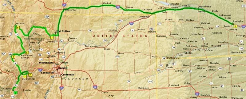
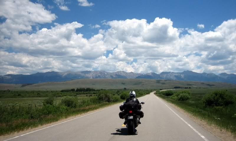
Day 9 Friday, July 6, 2007 Start: Leadville, CO, 8:00 am End: Lexington, NE, 10:00 pm Mileage: 626
The route for Day 9: Leadville, CO to Lexington, NE. The last day of twisties before hitting the slab for home.
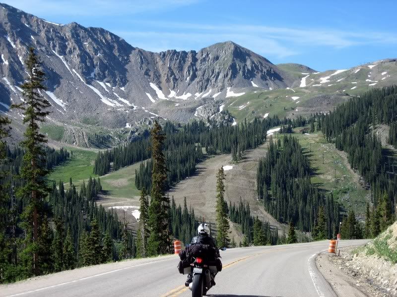
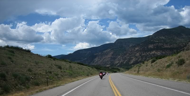
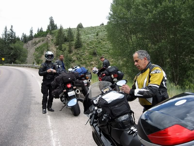
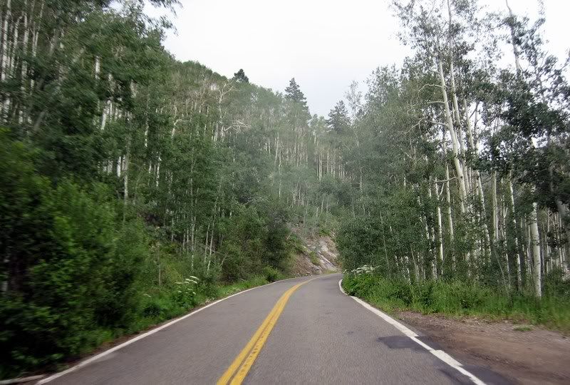
Today would be the last day of twisties with the Rocky Mountains spitting us out onto the freeway in Fort Collins. The highlights would be the Eisenhower Tunnel, Loveland Pass and then some unexpected joy towards the end. We met up with Jim Williamson from the Sport-Touring.Net motorcycle forum, who lives in Fort Collins and offered to show us a few good roads in the area.
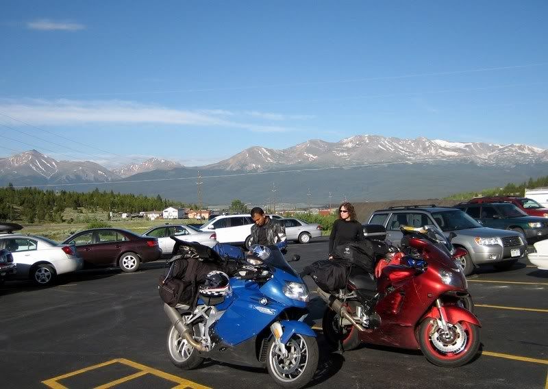
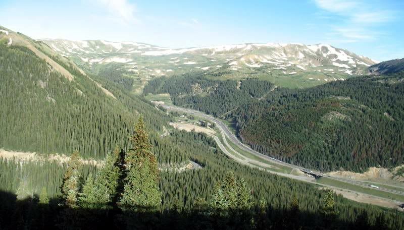
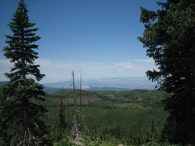
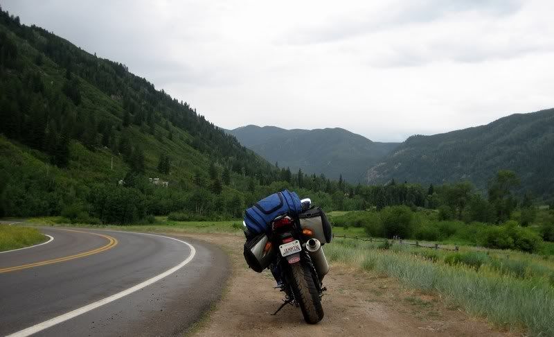
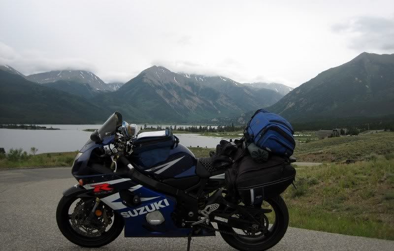
As always, in the morning, the storm clears. Looking back at where we rode through from our Super 8 in Leadville, CO, the highest town in the US at 10,152 ft. (Picture by Andy)
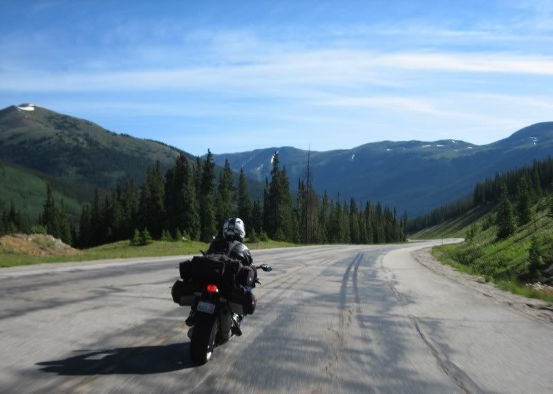
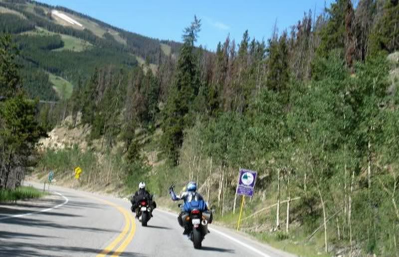
Heading to Dillon on CO-91
Twisties in the fresh mountain morning air… just what the doctored ordered.
Andy on CO-91.
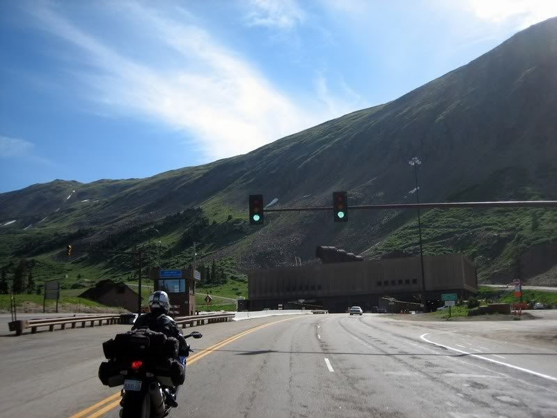
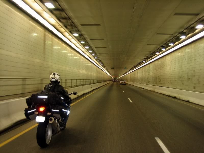
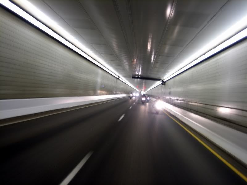
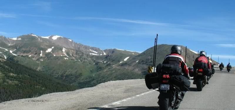
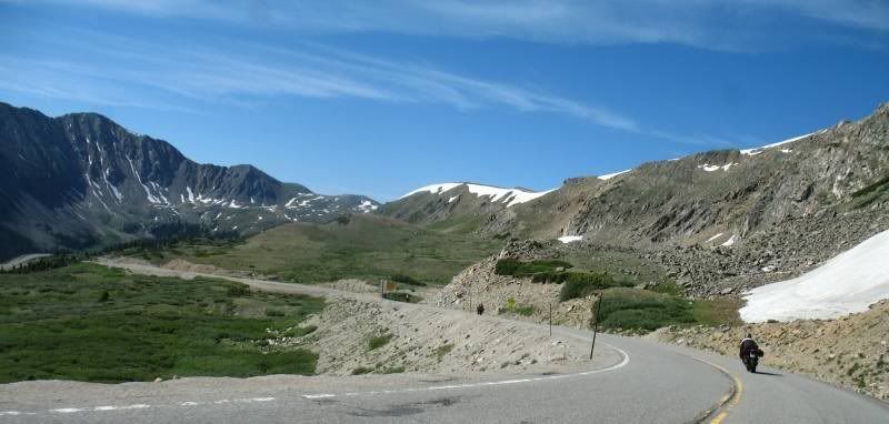
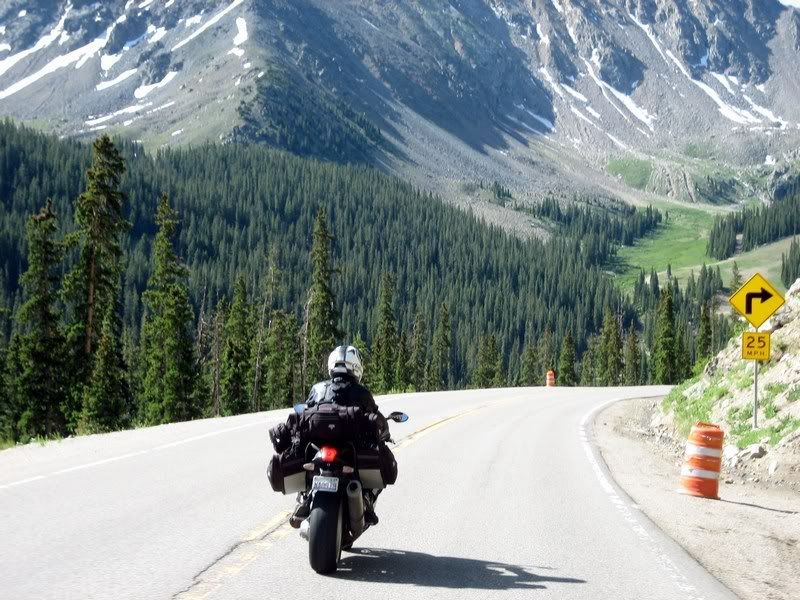
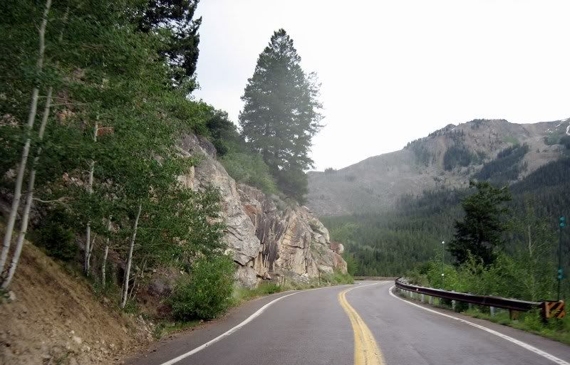
After meeting up with Jim in Dillon, we rode up I-70 to ride through the Eisenhower Tunnel, which is an engineering marvel being the highest vehicular tunnel in the world at 11,158 ft and it's about 1.7 miles long. We exited right after the tunnel and made the loop back to Dillon on Loveland Pass, which was the old way around these parts before the tunnel. HazMat Cargo still has to take Loveland Pass up and over as they are banned from traveling through the tunnel due to potential safety hazards and not having escape tunnels for traffic. There was considerable construction on both sides of the pass, but the other parts were still fun to ride and the scenery on the western side is quite picturesque. This is when we noticed Jim's unique way of riding his Honda Magna with his legs straight out on the highway pegs. He railed like this through the corners, which was great to see.
One of the few traffic lights on the Interstate system on I-70 at the west entrance to the Eisenhower Tunnel. It's probably used to direct traffic during weather hazards or other tunnel incidents.
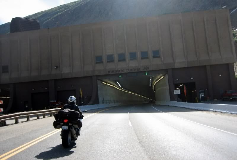
Entering the eastbound Johnson Tunnel.
The Eisenhower Tunnel system is the highest vehicular tunnel in the world at 11,158 ft and it's about 1.7 miles long.
Looking back at the group.
Looking down from Loveland Pass Road at the east entrance of the tunnel. (Picture by Jim Williamson)
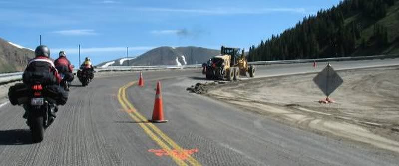
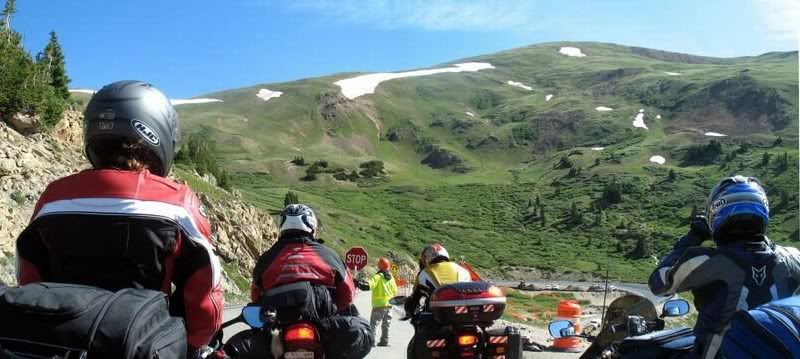
After riding the tunnel east, we took the old Loveland Pass Road to make a loop back into Dillon. Trucks and other haz-mat vehicles are banned from the tunnel and must make the twisty journey up and over the pass. There was lots of construction on both sides of the pass.
24 Loveland Pass, US-6 [4:54] Riding up and over Loveland Pass, US-6 around the Eisenhower Tunnel. There's some construction on both sides of the pass, but good riding still / Andy Musik: Barenaked Ladies - If I Had A Million Dollars My Rating > Road: 5/5, Scenery: 5/5
Loveland Pass Road (Picture by Jim Williamson)
Construction on one of the hairpins (Picture by Jim Williamson)
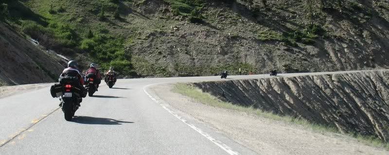
Riding some awesome corners on the way up to the summit. (Picture by Jim Williamson)
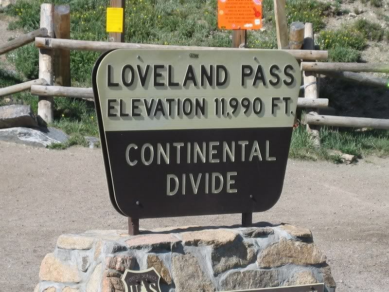
The Loveland Pass summit at 11,990 ft.
Aileen, heading west, down the mountain. (Picture by Jim Williamson)
Construction on Loveland Pass Road, western side.
Construction on Loveland Pass Rd, western side. (Picture by Jim Williamson)
No guard rails even in the sharpest of corners…
With stunning scenery like this, extreme concetration was required to focus on riding the road (besides taking this picture while riding, of course).
Loveland Pass Road (Picture by Jim Williamson)
Looking back and taking a picture of… (Picture by Jim Williamson)
Jim, who joined us from the Sport-Touring.Net forum, riding an '84 Honda Magna V-65. The craziest thing was his riding style, with his legs straight on his pegs through all the twisties. And man, could he ride!
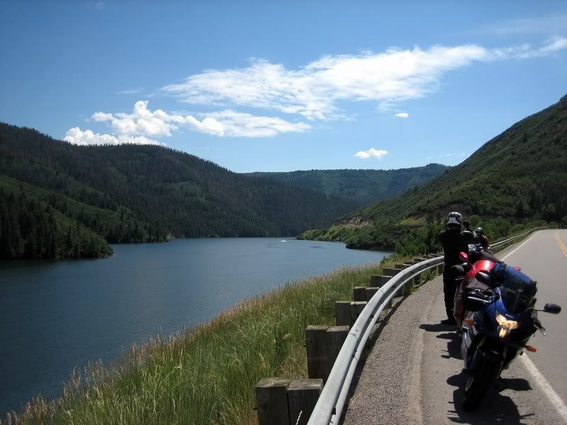
Heading back into town with the Dillon Reservoir in the background.
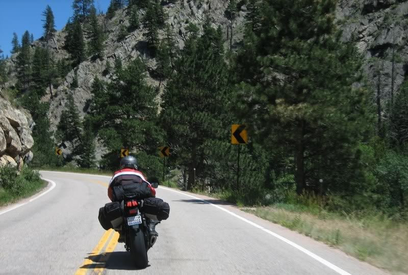
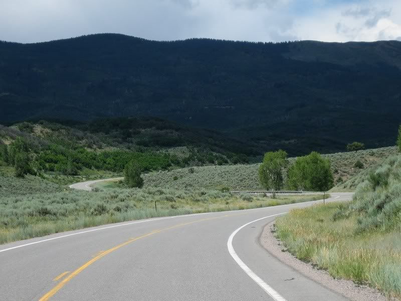
From there we headed north around the Rocky Mountain National Park, as there was scheduled heavy construction through the park's roads. Heading to Kremmling on CO-9 was kind of boring with nothing much to see or ride. This whole area is located in a huge basin called North Park and nearby is, you guessed it, South Park, where the cartoon show gets its name. After the decent US-40, CO-125 turned out to be another real gem. This road has almost no traffic, terrific sweepers and lots of 35 mph marked corners. The road surface wasn't the best, but we'll take it. The close proximity of the trees added a bit to the sensation of speed.
Heading north on CO-9 into Kremmling along the Green Mountain Reservoir.
Besides that bit, CO-9 was quite boring. (Picture by Jim Williamson)
Railing on CO-125, an awesome stretch of twisty pavement, heading into Walden, CO.
25 CO-125 [5:22] Riding the nice and rhythmic CO-125 north towards Walden, CO. The road surface wasn't perfect but the curves were very nice / Solo Musik: Sunfreakz - Riding The Waves My Rating > Road: 5/5, Scenery: 3/5
Yes, there were tar snakes abound, but they didn't bother too much. The riding was good.
Andy and I on CO-125. (Picture by Jim Williamson)
CO-125 straightens out after coming down from Willow Creek Pass. This whole geographical area is actually called North Park. And on the other side is, you guessed it, South Park, where the show gets its name from.
Taking a break in Walden, CO. (Picture by Andy)
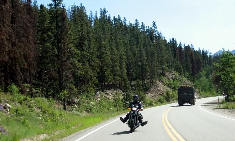
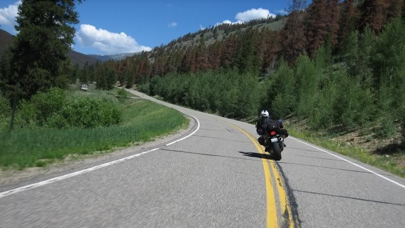
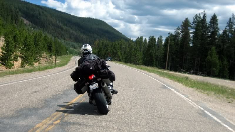
After gassing up in Walden, we took the crowded, scenic CO-14 towards Fort Collins. I was leading Andy and we weren't really riding all that fast when I got a radar blip around a corner and for a second was debating whether this was an erroneous detection or the real thing. Coming around the corner, we saw officer friendly with somebody already pulled over and pointing us to pull over behind him. We gladly obliged and waited patiently. The rest of the group rode by, once again pretending like they didn't know us. The officer was in an ok mood and said he got us doing 57 in a 45. Phew, that's not bad. After hearing that we were touring from Chicago, he didn't even check our licenses and just gave us a verbal warning to slow down and stop scaring any of the locals. He said this road sees lot of sportbike traffic from Fort Collins and looked like enforcement was being stepped up to protect the cagers going camping and fishing in the area. We caught up with the rest of the group and they couldn't believe that all we got was just warnings. Lady luck rides pillion.
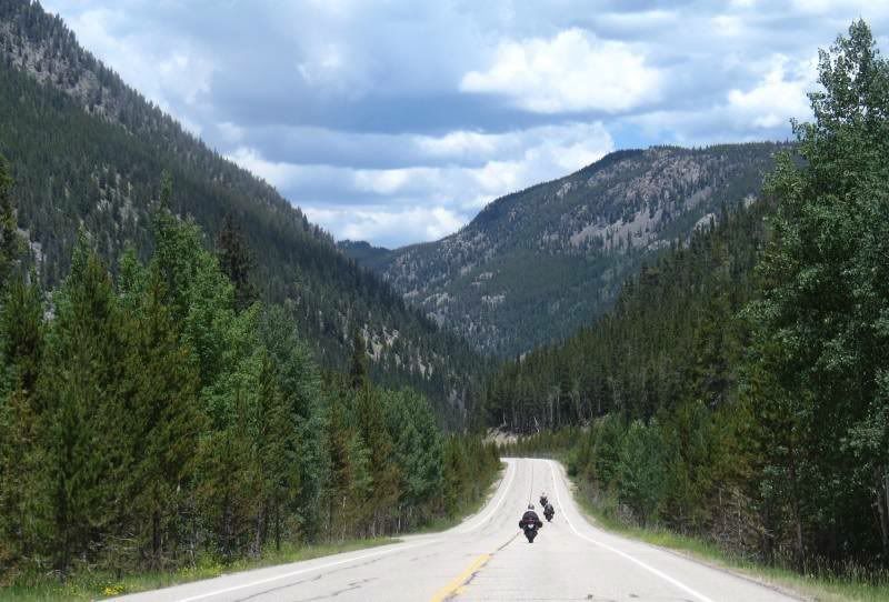
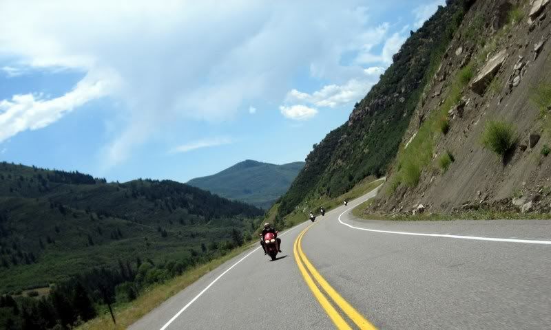
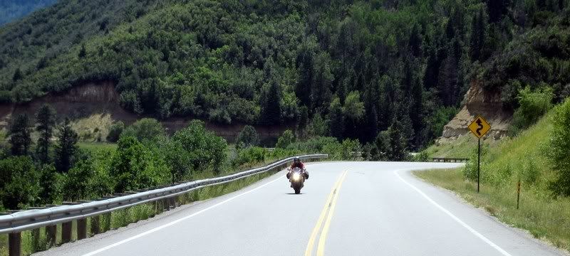
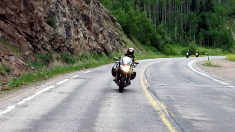
CO-14 was getting even more exciting to ride as it entered a canyon system, but it was plagued with traffic. To rescue us, Jim took us on an amazing short-cut into Fort Collins on Stove Prairie Road. This was one of the highlights of the trip with this road rivaling Deals Gap. Check out the video and see the constant direction change and with smooth corners marked at 15 to 20 mph. These are not the same as 20 mph corners marked in Wisconsin, which are basically 90 degree turns. There were designed much better and were proper chicanes. Trying to keep up with Jim, who probably has this road memorized, was quite a task. The road surface was also very smooth but there were some big gravel spots, but not too much. Aileen dropped her bike just as we turned on to Stove Prairie as there was considerable gravel on the tight right turn. No biggie, she didn't even go down with the bike and was raring to get going right away. Jim promised that there'd be no more gravel and to our amusement, just a few hundred feet into the road we came across big patches of gravel. There were definitely some pucker moments with the road changing direction quite fast over some crests and decreasing radius turns that tightened up more than expected. I had tremendous fun on this road and am jealous of the motorcyclists living in Fort Collins, who have so much access to this fun ride.
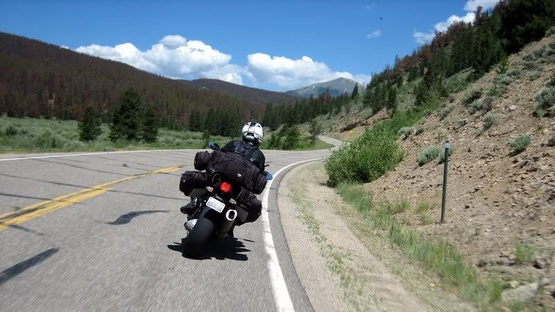
Heading towards Cameron Pass on CO-14, our last mountain pass on this trip before hitting the slab for home.
Andy riding Cameron Pass on CO-14.
Aileen riding Cameron Pass on CO-14. (Picture by Jim Williamson)
26 CO-14, Cameron Pass [4:09] Riding our last mountain pass on CO 14's Cameron Pass / Andy Musik: Kate Bush - Running Up That Hill My Rating > Road: 4/5, Scenery: 4/5
Andy on CO-14.
CO-14 (Picture by Jim Williamson)
CO-14 (Picture by Jim Williamson)
Aileen on CO-14.
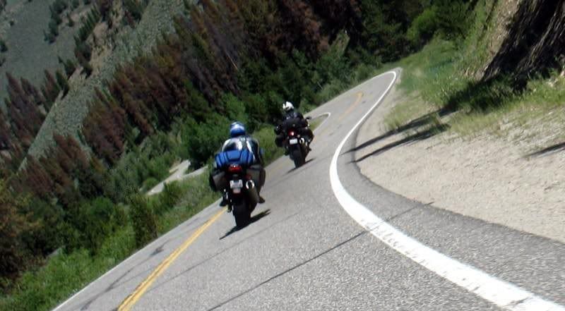
Rick, Steven and Aileen on CO-14. (Picture by Jim Williamson)
Andy on CO-14 with Jim in the lead, taking us to Stove Prairie Road.
27 Stove Prairie Road [5:32] Railing on the awesome Stove Prairie Road just outside of Fort Collins, CO. Looks like the road engineers didn't have a straight ruler with them - thank goodness! / Steven, Jim Williamson Musik: Hed Kandi (Hott 22) - Make Up Your Mind My Rating > Road: 5/5, Scenery: 3/5
We entered Fort Collins and headed for a late lunch at Aileen's brother's house. After a good break, we hit the slab for home. Aileen and Steven were feeling quite guilty as they had left their children and family for over 9 days now and were eager to get back home. So, we stepped up the mileage and instead of doing an easy 140 miles of slab with two more days of interstate riding, we decided to do about 320 today and finish the remaining 700 or so the next day.
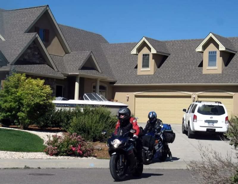
Leaving Aileen's brother's house in Fort Collins, after a nice lunch and rest. (Picture by Jim Williamson)
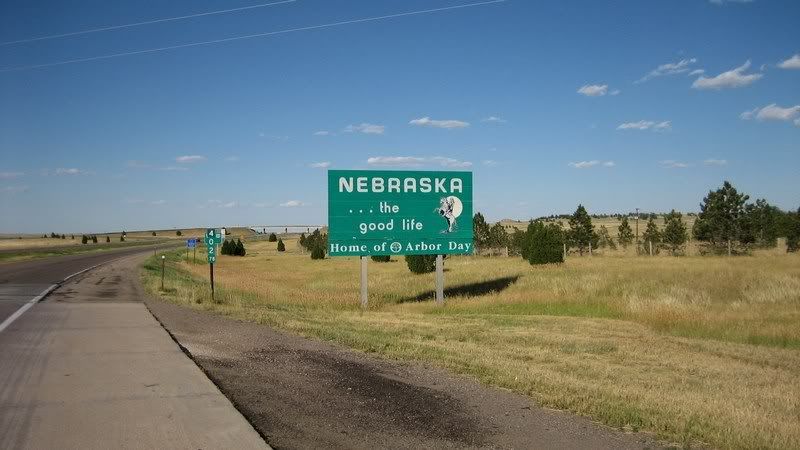
It's always a bit dreary to ride I-80 through Nebraska as there's no decent scenery to look at or any interesting cities along the way, unlike North or South Dakota (just marginally, though). We joked that Nebraska's main purpose was probably just to support everybody that was crossing the state on I-80. There's nothing really to stop and check out in the state besides the towns of Omaha and Lincoln. The western part of the state also had a strong manure smell in the air. One of the joys and probably downfalls of riding a motorcycle is getting to experience the local surroundings, including the smells, good and bad.
Oh yeah, baby - Nebraska, the good life… slabbing it home. (Picture by Andy)
Day 8 Thursday, July 5, 2007 Start: Moab, UT, 8:45 am End: Leadville, CO, 7:30 pm Mileage: 432
The route for Day 8: Moab, UT to Leadville, CO, ending with Independence Pass.
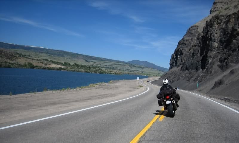
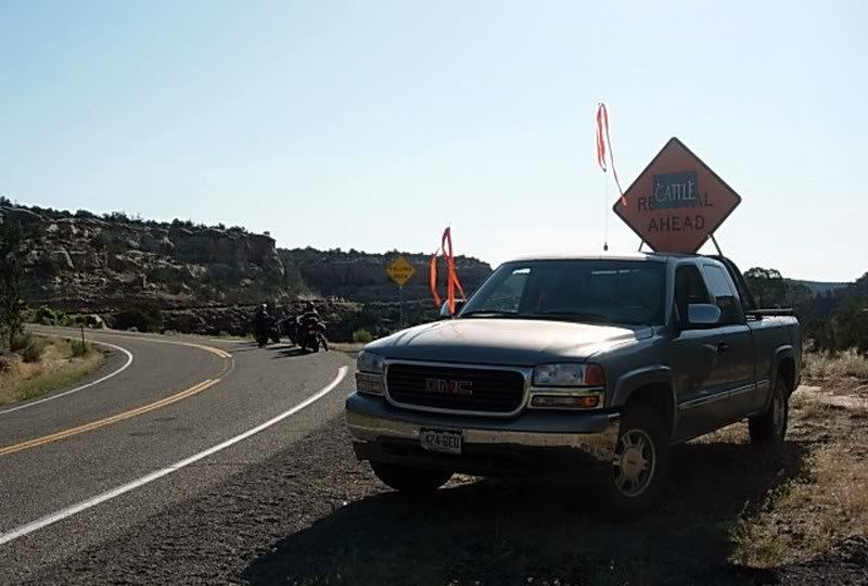
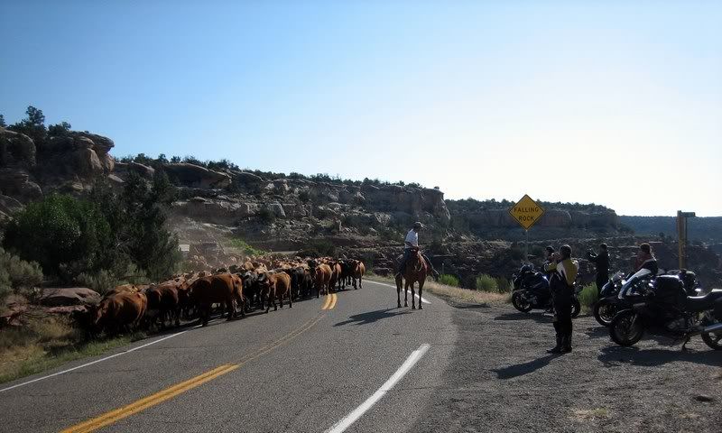
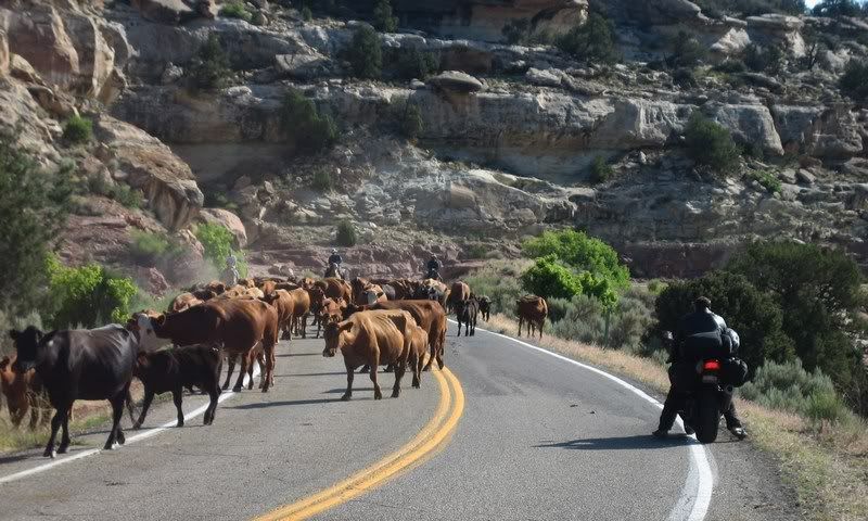
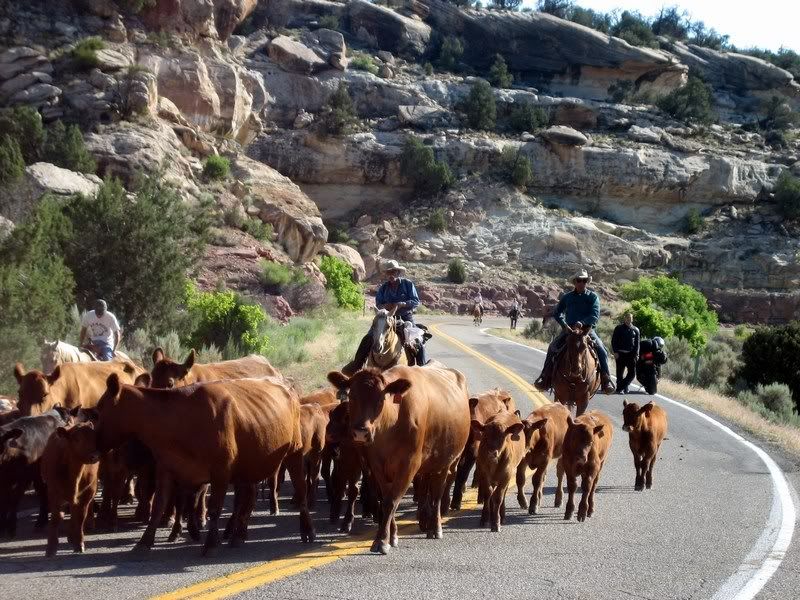
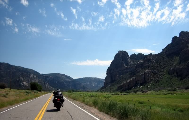
Saying goodbye to Utah, we would be riding through central Colorado on various twisting roads today as we headed east towards home. Crossing into Colorado on CO-90, we were stopped for about 15 mins as a massive herd of around 300 cattle made their way down the mountain from grazing up there during the spring. After being amused by the beef, we had to deal with their fresh lethal cow pies that were scattered all over the road ahead of us. We had to put more separation between us to stop getting cow dung flung onto us and our bikes from the bike ahead. A quick wipe down was needed at the next gas stop.
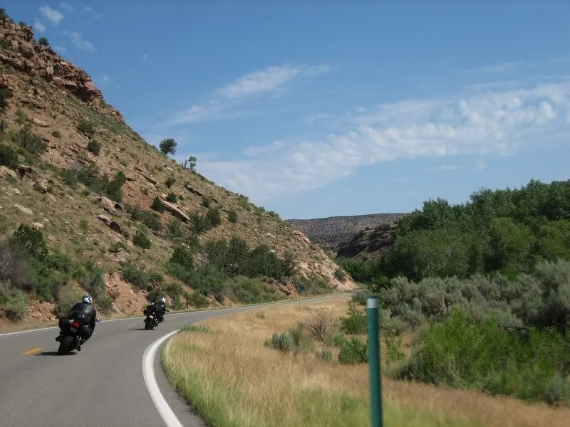
One last twisty in Utah on UT-46, before crossing into Colorado.
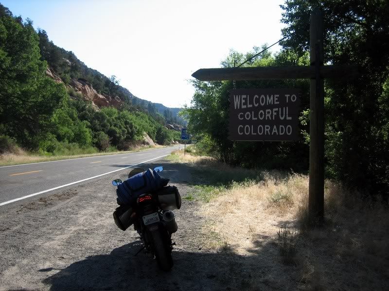
Again, the sign could use a bit more color, I say.
"Cattle Ahead" and not just one or two… (Picture by Rick)
…a whole herd of cattle, about 300 strong. They were coming down the mountain after grazing up there during the spring.
Steven, trying to make his way through the throngs.
The only downside to this was the danger to us riders from all the fresh cowpies that were dropped on these twisties that we'd be riding.
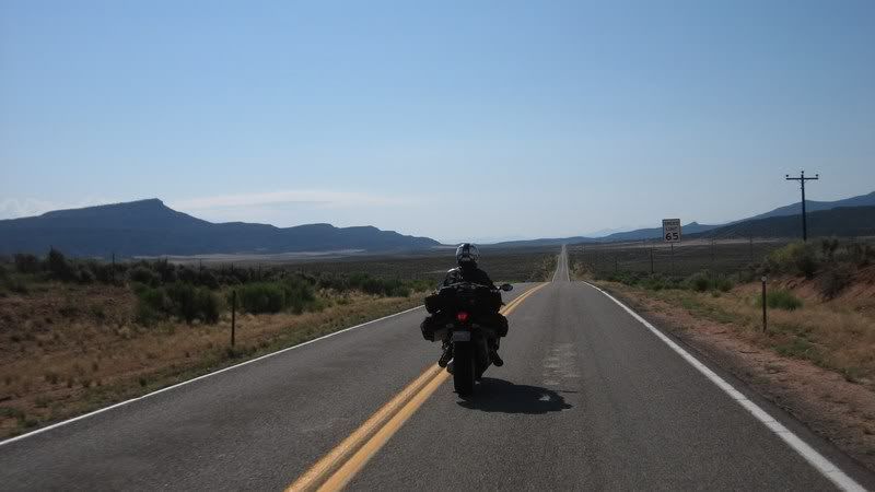
A straight shot into Naturita, CO to gas up. Hopefully this would be the last straight road we'd have to ride until the slab home.
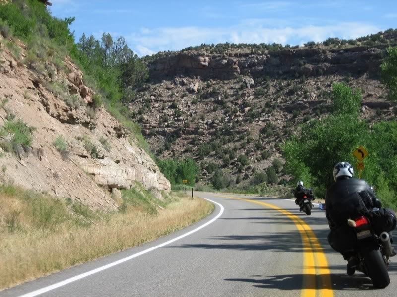
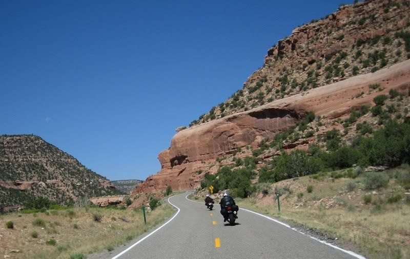
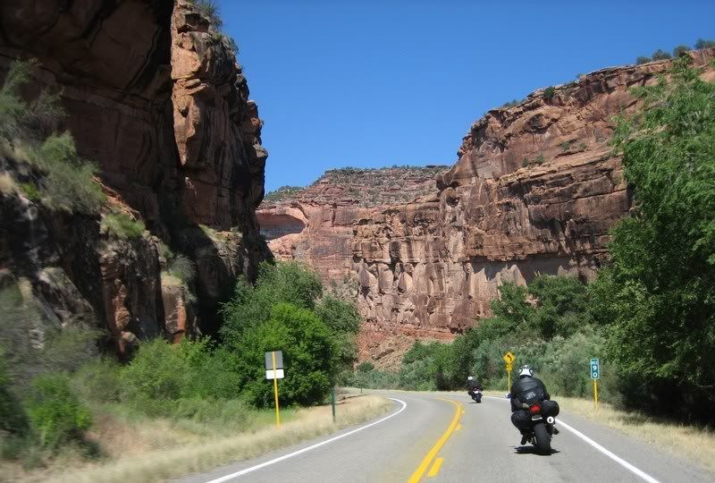
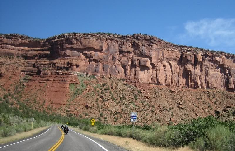
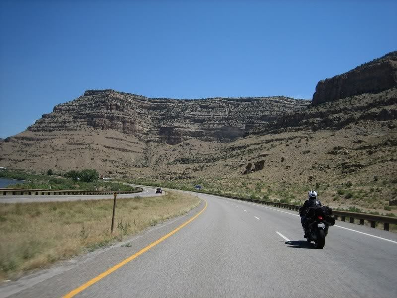
Even though CO-141 looked twisty on the map, I didn't think it would be as much as fun as it really was. The turns were a bit tighter as this area continues the red canyon landscape from nearby Arches National Park. In my mind, riding Colorado was always pictured as tree filled mountainous passes, not canyon riding. What an amazing state.
Heading north on the awesome CO-141. Lots of twisties with good scenery.
17 CO-141 [4:48] Riding CO-141 in the western part of Colorado. No high mountain passes here, but awesome red canyons that carry over from Utah / Andy, Steven Musik: Led Zeppelin - Stairway to Heaven My Rating > Road: 4/5, Scenery: 3/5
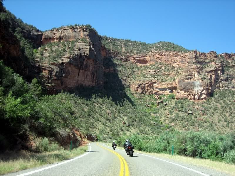
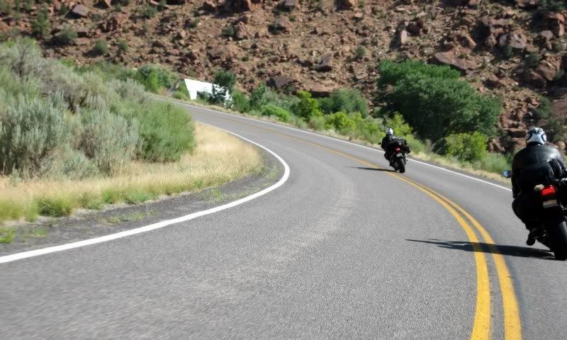
Steven and Andy on CO-141.
Steven and Andy on CO-141.
Steven and Andy on CO-141.
Images of red rock canyons aren't usually associated with Colorado, but being so close to Arches, it's not so surprising.
Steven and Andy on CO-141.
One thing funny about Colorado state highway signs is that the state flag takes up half the sign, leaving less space for the highway number.
Steven and Andy on CO-141.
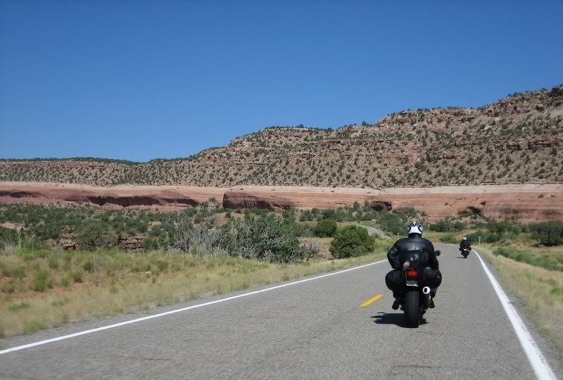
The scenery changed from dry canyons to a semi-lush landscape.
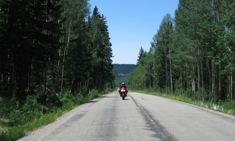
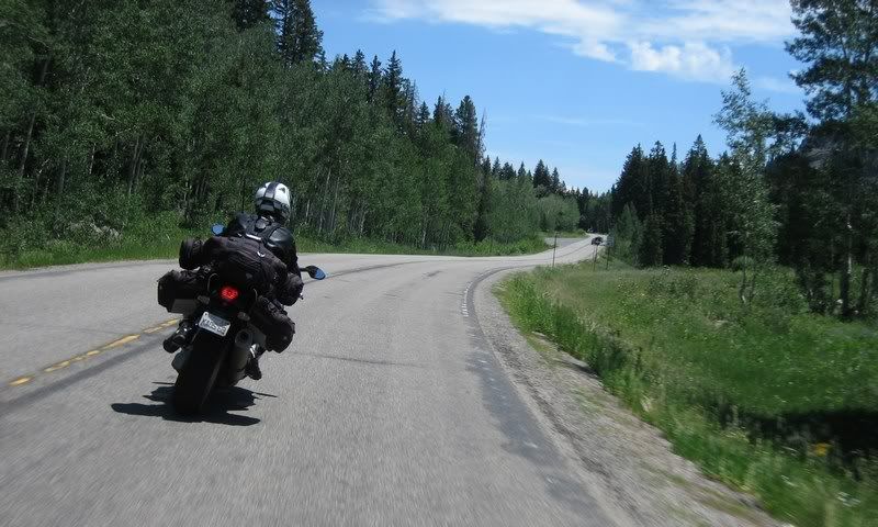
We hopped on I-70 for a bit from Grand Junction to the start of CO-65. This state continues to impress as its interstates are actually enjoyable to ride and scenic and probably don't warrant being called slab. The nice thing about CO-65, the Grand Mesa Scenic Byway is that the fun starts right as soon as you exit the highway. The first part is characteristic of dry canyon railing, then changes to a foresty mountain pass up and over Mesa Lakes.
Riding a bit of I-70 from Grand Junction to the start of CO-65. Interstate in this part of the country isn't so bad.
18 CO-65 Canyon Railing, Grand Mesa Scenic Byway [3:56] Canyon Railing on the first half of CO-65, Grand Mesa Scenic Byway. Heading south towards Grand Mesa / Andy Musik: The Black Eyed Peas feat. Sergio Mendes - Mas Que Nada My Rating > Road: 5/5, Scenery: 3/5
Steven riding to the top on Grand Mesa Scenic and Historic Byway, CO-65, a very fun road.
Andy, Grand Mesa Scenic and Historic Byway
Looking down from the peak at Mesa Lakes.
Doing what (male) motorcyclists do best.
Looking back at Aileen as we ride down into Cedaredge, CO.
19 CO-65 Mountain Pass, Grand Mesa Scenic Byway [5:02] Riding up and over CO-65 on the Grand Mesa Scenic Byway towards Cedaredge, CO / Andy Musik: Bob Marley - Could You Be Loved My Rating > Road: 4/5, Scenery: 4/5
Beautiful road conditions.
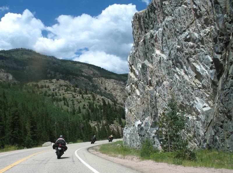
After a break in Hotchkiss, we hoped on CO-133 towards the last feature of the day, Independence Pass. Just like on previous trips, the most fun always comes when you're least expecting it. CO-133 around the Paonia Reservoir was my favorite road of the whole trip. It was constant 35 mphs turns with nice smooth pavement with beautiful mountain and lake views. Let me move here, already!
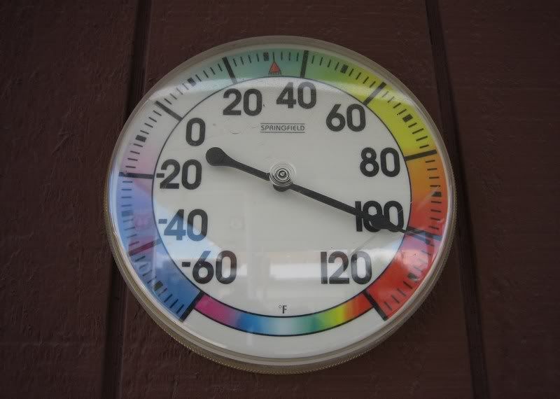
Proof of the temperature at a Hotchkiss gas station. Mind you, this was in the shade.
Riding the awesome CO-133 from Hotchkiss to Carbondale, CO.
This was one of my favorite roads of the whole trip. Constant 35 mph turns.
20 CO-133 Paonia Reservoir [5:07] Railing on CO-133 around the Paonia Reservoir. This was my favorite road on the whole trip. Constant 35 mph turns allowing for a nice rhythm to be set. And check out the scenery too. I want to move here! / Solo Musik: Alice DeeJay - Better Off Alone My Rating > Road: 5/5, Scenery: 5/5
Aileen, coming out of riding some twisties.
Enjoying the view of the Paonia Reservoir.
More fun on CO-133
Steven, with some impressive peaks up ahead.
21 CO-133 McClure Pass [3:33] Riding up and over CO-133's McClure Pass in drizzling rain / Andy, Steven Musik: Dire Straits - Lady Writer My Rating > Road: 4/5, Scenery: 5/5
Aileen, clearly happy to be riding this awesome road. (Picture by Andy)
Taking a roadside break (Picture by Aileen)
Rick, on the last stretch of CO-133.
Crystal River, heading into Carbondale.
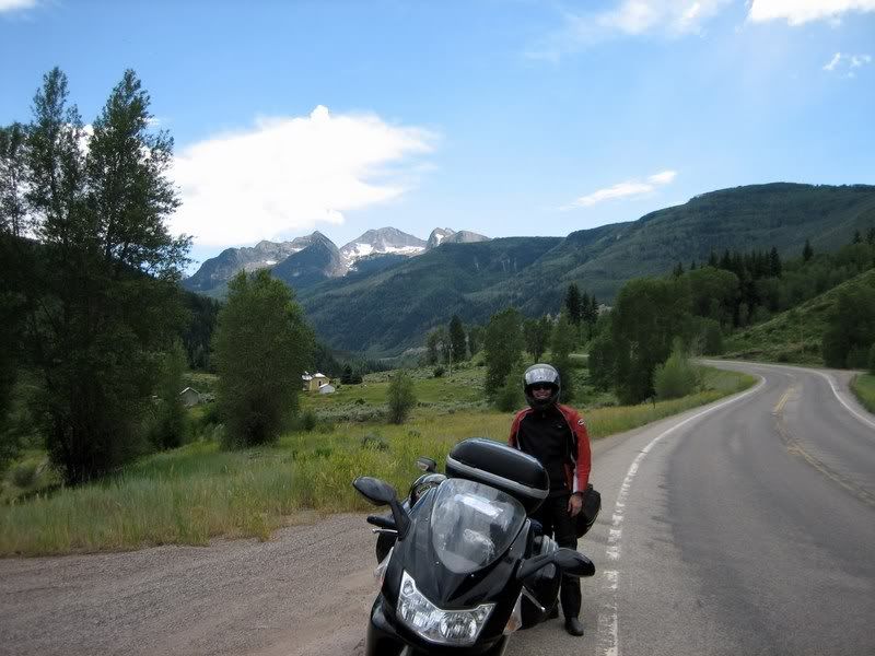
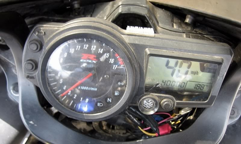
Crossing 40,000 miles on the odometer in Carbondale, CO. Myra's an awesome bike. Let's see if we can cross a 100K…
We encountered a bit of rain as we pulled into Carbondale, just as I crossed 40,000 miles on my 2004 GSX-R600. I think Suzuki should buy back my bike when I cross 100,000 miles to study reliability of their supersport bike. I could use a new bike by then.
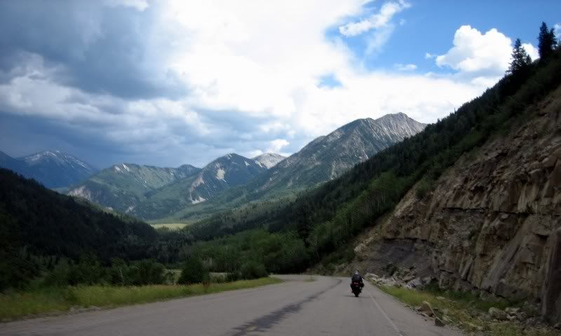
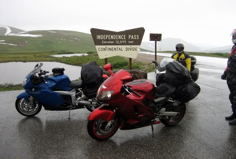
I was hoping we could stop in the beautiful town of Aspen for a late lunch but a big storm was moving through and traffic was crazy mad in town. There's a four-lane highway all the way from the freeway into Aspen and traffic was constant the whole way. We got started on the road up to Independence Pass in a steady downpour, which wasn't too dampening on the spirits since traffic was quite dense on the road. The views and the road resembled the Going-to-the-Sun road in Glacier National Park and it was actually quite beautiful in the rain. The temperatures were in the mid 30s when we passed the summit at 12,095 ft and Aileen, being the smart rider she is was watching out for possible black ice forming on the roads that could slip us over the edge of the mountain. Steven was cold to the bone and just railed down the mountain, wanting to get to a warm hotel room as soon as possible. Coming down on the eastern side, there are no guard rails around the switchbacks and the 10 mph speed limit was duly followed. Just as the rain subsided, we pulled into the town of Leadville, which is the highest town in the US at 10,152 ft.
Heading into the rain-soaked mountains of Independence Pass on CO-82, south of Aspen.
The road was truly beautiful to ride through. Close foliage and good road quality.
22 Independence Pass Uphill, CO-82 [6:24] Gently riding up CO-82 from Aspen to Independence Pass. Too bad we had to ride through here during a downpour, but it's beautiful nonetheless. It almost resembles the Going-To-The-Sun Road in Glacier National Park / Solo Musik: Bob Dylan - Tambourine Man My Rating > Road: 5/5, Scenery: 5/5
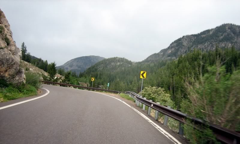
CO-82
The views were also stunning, almost like Glacier National Park. I couldn't stop to take any pictures of the scenery as traffic was constant and serious rain was on the way.
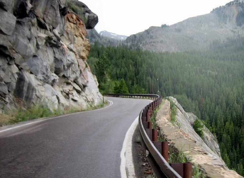
A winding wet mountain road with steep rocky drop-offs.
CO-82
The summit of Independence Pass at 12,095 ft, the second highest paved road in the US. This is well above the tree line and there's only tundra up here. The temperatures were in the mid 30s, plus it was raining. We were cold. (Picture by Aileen)
The wet peak of Independence Pass. We were hoping it wouldn't get cold enough to start forming ice. That would be bad through these no-guard rail hairpins.
23 Independence Pass Downhill, CO-82 [7:05] Gently riding down from Independence Pass (12,095 ft) in the rain with no guard rails. Heading east to Twin Lakes, CO / Solo Musik: The String Cheese Incident - Take Five My Rating > Road: 4/5, Scenery: 4/5
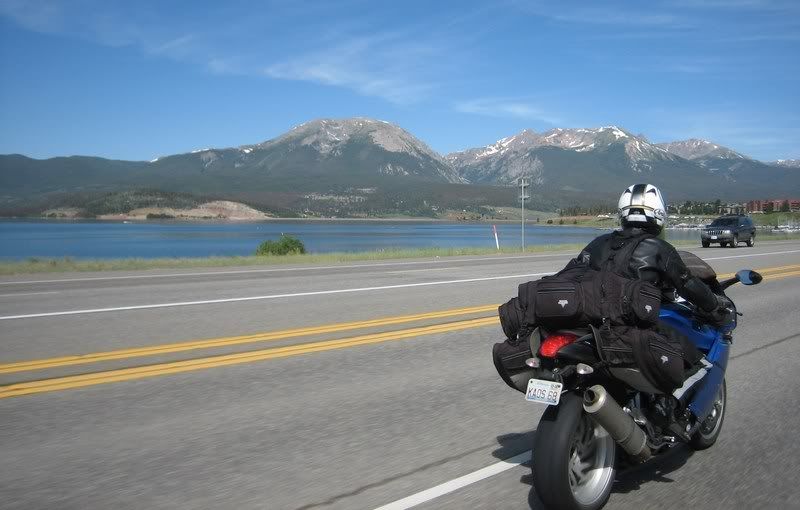
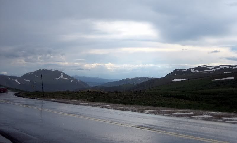
At the bottom of the pass, at Twin Lakes, CO. The mountains create their own weather system.
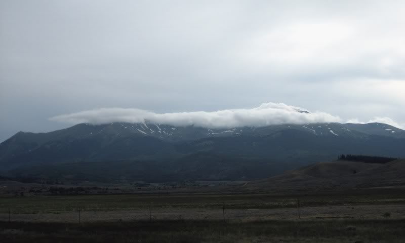
The clouds hanging around at the mountain peaks, where it's nice and cool for them, creating havoc for us riding through there.